 wetlands in Galveston Bay, Texas. Colors indicate wetland loss. See caption for details." />
The watershed of Galveston Bay is home to half of Texas’ population, and it hosts three ports, plus a hub for manufacturing and refining chemicals and petroleum. These urban assets complicate the task of protecting water quality, habitat, and natural resources. Local advocates for bay health helped create the annual Galveston Bay Report Card, a scientific analysis informed by Digital Coast land cover and change data, which is heightening awareness and actions to preserve water quality, habitat, hazard resilience, and other natural assets. The card also provides context for major regional events, such as hurricanes, droughts, and oil spills. It is supported by a Houston Endowment grant and produced by the Galveston Bay Foundation and Houston Advanced Research Center.
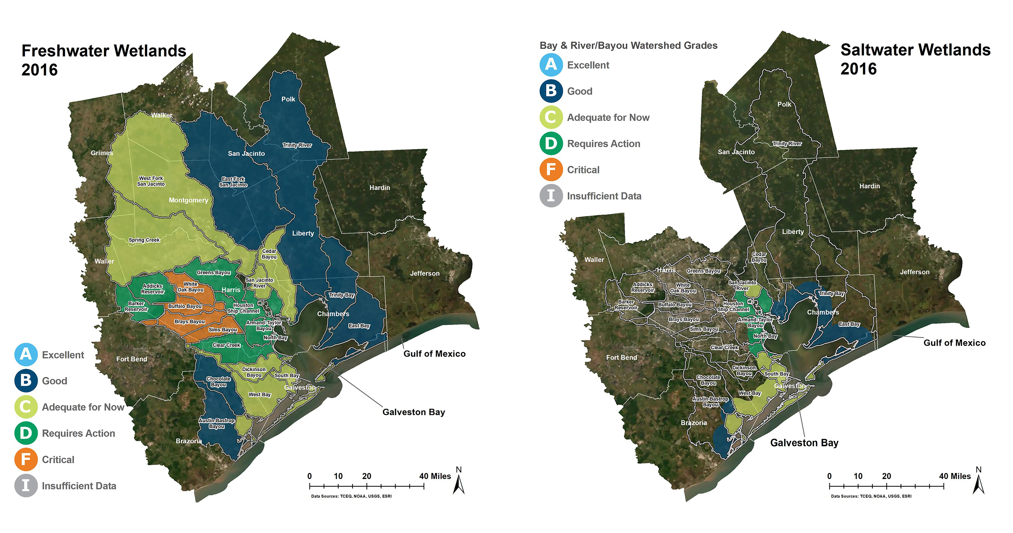
The land cover and change data from 1996 through 2016 were used to help calculate the percentage of palustrine (freshwater) and estuarine (saltwater) wetland losses.
wetlands in Galveston Bay, Texas. Colors indicate wetland loss. See caption for details." />
Report card presentations have spurred volunteers to restore local salt marshes. In addition, 150 people have attended Wetland Walkabout tours of a restored freshwater ecosystem, and 160 people have attended the Squawk Walk event to learn about local and migratory birds in freshwater wetlands.
Report card grades feature six indicators—water quality, pollution events and sources, wildlife, habitat, human health risks, and coastal change. Community members can take steps in their own backyards to help the bay by consulting the Find Your Watershed tool and the report card’s “What You Can Do” section. (2021)
Partners: Galveston Bay Foundation, Houston Advanced Research Center, Houston Endowment, Digital Coast